The best hikes in LofotenThe best hikes in Lofoten
Which hikes are best depends on one honest question: what do you want from them? The famous summits and the famous pictures — shared, in season, with a great many others. Or a lesser-known peak nearby: just as fine a summit, a fraction of the people. Both answers are right.In winter the list shortens but does not close: a few summits remain honest trips for the properly equipped — and the coastal walks carry the season. Both are in here.
Before you lace up
This guide covers the most famous hikes across the whole of Lofoten — sorted with the west first, where the classics cluster — and for each one gives you the time, the elevation, who it suits and what the top actually shows you. Where we know a quieter equal, we say so. First, the ground rules:
The ground rules
The hikes of the west
Reinebringen — the most famous of them all
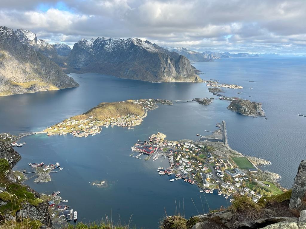
The view that made Lofoten world-famous: Reine, Hamnøy and Sakrisøy laid out beneath you, the Reinefjord threading between the peaks. One look explains every photograph you have seen.
The honest part: the trail is a stone staircase built by Nepalese sherpas, and more than two thousand steps is a serious leg day in either direction. In high season the staircase moves at queue pace in places — go early or late in the day, and when conditions allow it, sunrise or sunset from the top is the finest version of all. The municipality closes the staircase outside the season; treat it strictly as a May-to-September hike.
It suits: reasonably fit walkers who want the definitive Lofoten view — and are happy to share it. The full guide, measured →
Volandstind — the quieter summit
When guests ask us where we go, this is the answer. Few people, a trail that is neither long nor punishing — and a summit panorama over sea, beaches and the jagged Flakstad peaks that gives the famous mountains genuine competition.
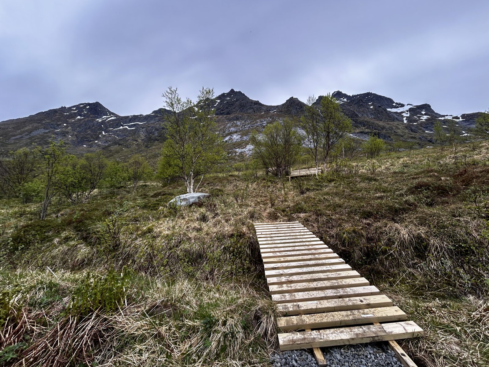
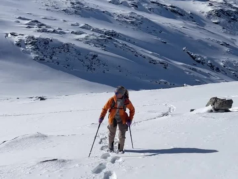
Volandstind can be walked in winter too: good footwear with spikes and poles usually carries the day, though some days ask for snowshoes. In summer it is simply a fine, quiet climb — and in the midnight-sun weeks, a superb place to watch the sun hold above the sea. The standing proof that “less famous” and “less beautiful” are different things.
It suits: anyone who wants the summit experience without the staircase or the crowd — and winter hikers with proper gear. The route from our door →
Did you know? — from Casa Lofoten
The Volandstind trailhead lies about 1.8 km from the house — a 20–25 minute walk, measured point by point by the hosts. Our guests’ favourite summit starts before the car does. Why we believe it’s the best base in Lofoten →
Skåtind — the demanding one
Taken from the back side, Skåtind is the west’s step up in seriousness: steep ground, real climbing metres, and a summit that repays the effort with the Flakstad coastline spread out below. This is not a first hike — it is the rewarding harder day for experienced, sure-footed walkers who found the classics comfortable. Full route details will follow in the individual guide.
It suits: experienced hikers wanting the west’s tougher summit.
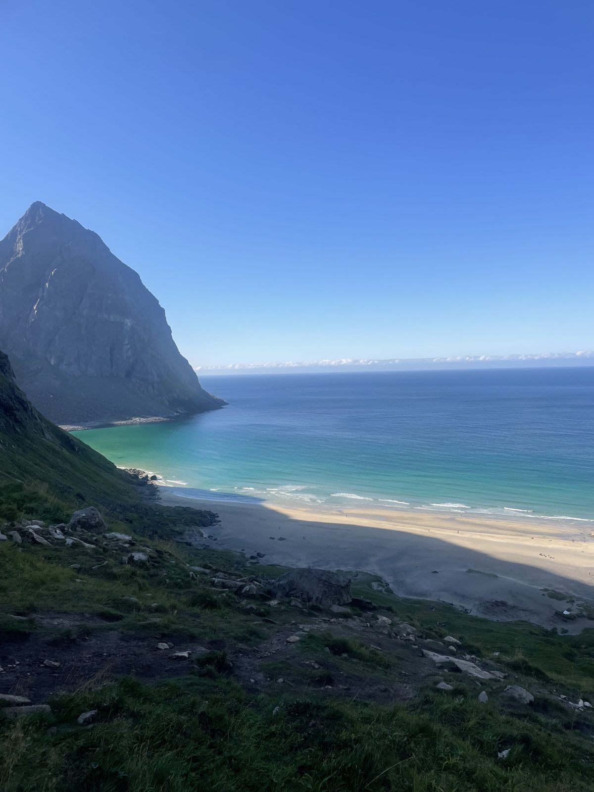
Kvalvika and Ryten — the beach and the summit above it
Kvalvika is the easy classic: from the parking by the lake, a clear trail over a low pass drops you onto a gold-and-turquoise beach reachable only on foot. Families do it happily, and the beach itself rewards unhurried time.
Ryten, the summit above, adds the aerial view — the whole beach and bay beneath your boots, with the famous rock ledge for the photograph. You can also start from the Yttersand side and take Ryten first — a few more metres of climbing, and a fine way to make a round of it.
It suits: Kvalvika, everyone including children; Ryten, anyone with a summit’s worth of energy left. Ryten, measured →
Munkebu — the bigger day in the far west
From Sørvågen, past a chain of mountain lakes, up chain-assisted slabs to the DNT hut beneath Munken — this is the west’s proper mountain day, with the Reinefjord peaks filling the horizon. Less staircase, more mountain.
It suits: experienced, sure-footed hikers wanting a fuller day than the postcard climbs offer.
Nesland to Nusfjord — the coastal walk with dinner at the end
A path along the open sea from Nesland to the preserved fishing village of Nusfjord — this is the hike we recommend on the days fog sits on the summits, and increasingly on clear days too.
Our own ritual: book a table in Nusfjord — ask for the window table — and let a good dinner be the summit. The trail can be walked in both directions, but walking home after a long, good dinner is heavy going — so either arrange a taxi back, or have someone drive the car around to Nusfjord so you drive home yourself.
It suits: everyone — and every weather that closes the tops. The walk, in detail →
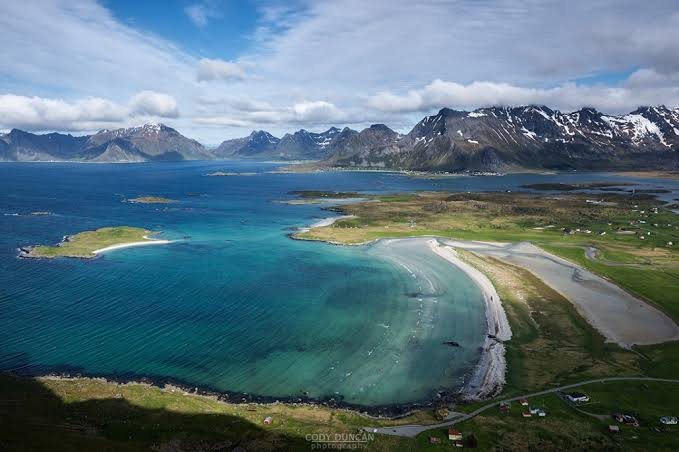
The Yttersand shore walk
A similar pleasure on the other side: from Yttersand, an easy walk along the sea, as far as the day feels like — the same way back. No summit, no logistics, just the coastline doing the work.
It suits: slow mornings, small legs, and days that want the sea rather than a climb.
Offersøykammen — the short climb over the strait
A somewhat steep beginning, then an easy, open plateau to a 360-degree summit: Nappstraumen below, Leknes across, Hauklandstranda gleaming to the north. Big reward for a short investment — a fine evening hike, and a fine midnight-sun summit too.
It suits: short-on-time days, sunset walkers, and anyone wanting maximum view per hour.
The hikes of the middle and east
Festvågtind
From the road it looks impossibly steep; in fact the route wraps around the mountain and never becomes too demanding by Lofoten standards. The summit serves Henningsvær whole — the village on its islets, bridges and sea. Start early for solitude, or time it toward the evening light. It suits anyone doing the Henningsvær day and wanting to see it from above.
Glomtinden
Between Kabelvåg and the Henningsvær turn-off, Glomtinden packs a remarkable panorama into an afternoon: start on the old gravel road by Rørvikvatnet, manage a little easy scrambling at the top, and stand in a 360-degree view — Vågakallen’s granite face, the open Vestfjord, Svolvær and Kabelvåg below. One of the best effort-to-view ratios in the islands. Sturdy footwear matters; the rock turns slick when wet.
Fløya and Djevelporten
Straight up from Svolvær on steep steps to two rewards: Djevelporten, the boulder wedged improbably between two cliffs, and the summit views over town, sea and the climbing spire of Svolværgeita. Airy in places — this one wants sure feet and a head for edges. Not the one for vertigo.
Tjeldbergtind
A gravel road, then a trail with a few steep moments, to a small summit with a disproportionate view over Svolvær, Kabelvåg and the sea lanes — easily fitted into half a day. For short days, easing-in days, and anyone based in or passing the east.
Justadtinden
From Hagskaret the trail climbs in patient stages — heath, a scatter of small lakes, the broad Justadheia — before one steeper push and the final ridge to the 738-metre summit, with sea views to both sides of the island for much of the way. The return is the same route. For hikers who like their mountains long and unhurried.
Hoven
Hoven rises alone from the flats of Gimsøya, which gives it something many higher peaks lack: open sea on the northern horizon. In the midnight-sun weeks that makes it one of the fine midnight-sun summits — as Offersøykammen and Volandstind are in the west. For midnight-sun evenings, families, and photographers.
Matmora
In the quiet north of Austvågøya, Matmora is the answer for hikers who want a real mountain day with almost nobody on it: a long approach, a sharpening ridge with some air under it, and sea views the whole way. For experienced hikers who came for the mountains more than the postcards.
Trollfjorden
No road reaches Trollfjorden. The fjord — barely 100 metres wide at its mouth, walled by sheer rock — is boat country, with daily departures from Svolvær. Most visitors simply take the cruise, while walkers can land at the quay and follow the marked trail toward Trollfjordhytta — including one demanding 300-metre climb — or continue up Isvasshaugen (502 m) for the great view back down the fjord. Avalanche terrain in winter; a calm-weather day trip east.
Choosing your week’s worth
If you take one idea from this guide, take the first one: match the hikes to what you want, not to a ranking.
A first visit based in the west covers most appetites in three climbs: Reinebringen for the famous view, Kvalvika or Ryten for the beach-and-summit day, and Volandstind — or another quiet top — for the day you want the mountain to yourselves. Around them, the coastal walks catch the soft-weather days, and the east’s summits wait for the day you drive that way.
And hold the plan loosely. The weather will reorder it — that is not the trip failing, that is Lofoten hiking working as designed. How many days do you need explains the slack.
“The perfect base also for exploring Lofoten, with many of the best hikes nearby and also great amenities (eg grocery and quality restaurants) nearby.”
Hiking, in short
What is the easiest famous hike in Lofoten?
Kvalvika beach — a clear trail over a low pass, manageable for families, with one of Lofoten's great beaches as the payoff. The Nesland–Nusfjord coastal walk and Tjeldbergtind are the other gentle classics.
What is the best hike in Lofoten with children?
Kvalvika for the beach, Hoven for an easy summit, the shore walks at Yttersand and to Nusfjord for flat days. Energetic older children manage Ryten and Offersøykammen well.
How hard is Reinebringen really?
It is a stair climb of more than 2,000 steps each way — short in distance, honest in effort. Reasonably fit walkers do it in 1.5–3 hours return. It is not a technical hike; it is a very long staircase with the best view in Norway at the top. The full guide, measured →
Can I hike in Lofoten in winter?
A few summits, yes — with proper equipment and experience. Volandstind is our own winter regular: good footwear with spikes and poles usually suffices, snowshoes some days. Reinebringen is closed in winter, and the general season for the classic hikes is April/May to October. Best time to visit covers the seasons.
How do I avoid the crowds on the famous hikes?
Go early or late in the day — sunrise and sunset are both quieter and finer. Or trade fame for quality: Volandstind and Matmora deliver the summit experience with a fraction of the company.
Which side should I hike Ryten from?
From the parking by the lake for the classic easy approach via Kvalvika, or from the Yttersand side — taking Ryten first — for a few more climbing metres and a rounder day. Both are good; the lake side is the gentler start.
What if fog covers the summits on my hiking day?
Swap, don't push: the coastal walks — Nesland to Nusfjord, the Yttersand shore — are made for exactly those days. And check the summit forecast anyway: the sun often shines above the fog, and standing on a top over a white sea of mist is one of the finest sights these islands offer.
Do I need hiking boots, or do trainers work?
Proper footwear with grip, always — the trails mix rock, roots and bog, and the weather changes mid-hike. In the shoulder seasons and in winter, add spikes and poles — sometimes snowshoes, depending on the hike and the snow conditions.
Hikes from the door
The Volandstind trailhead is a 20–25 minute walk from the house, Kvalvika and Ryten are 15–20 minutes by car, and Reinebringen about half an hour — with the sauna waiting for the legs afterwards.