Volandstind
E–02
SKJELFJORDEN · FLAKSTADØYA
Ask us where we go, and this is the answer. Volandstind gives you a genuine Lofoten summit — sea on every side, beaches glowing below, peaks stacked to the horizon — with a fraction of the people the famous staircases carry. It is neither long nor punishing, it works in every season for the properly shod, and in the midnight-sun weeks the top is a front-row seat to the sun holding above the northern sea.
The mountain you can point to
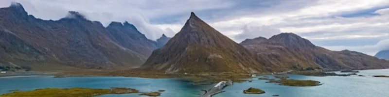
You have almost certainly seen this mountain already. Seen from the Fredvang side, Volandstind is the sharp pyramid rising behind the famous bridges — one of the best-known motifs in Lofoten, photographed from the roadside every single day.
From that side it looks properly serious. Which makes the quiet truth of this guide rather satisfying: the back side is a much friendlier climb. Walk it from Skjelfjorden, and for the rest of the trip you can point at one of Lofoten's famous silhouettes and say, honestly, that you have stood on top of it.
The view from the summit
Getting there & parking
Trailhead
Skjelfjorden grendehus — the yellow community house on Skjelfjordveien, on the Skjelfjord side of Flakstadøya.
Good parking by the house; the trail starts from its edge. No fees, no trailhead queue.
Getting here
Skjelfjordveien leaves the E10 on Flakstadøya and follows the fjord. About 20–30 minutes' drive from Reine, 30–40 from Leknes.
Staying near Skjelfjorden? This is a walking-distance mountain — boots on at the door.
Route map
Elevation profile
The route, stop by stop
The path along the edge
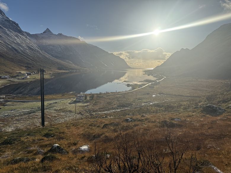
From the grendehus the trail climbs gently up along the edge, Skjelfjorden opening below you.
The gapahuk — 15 minutes in
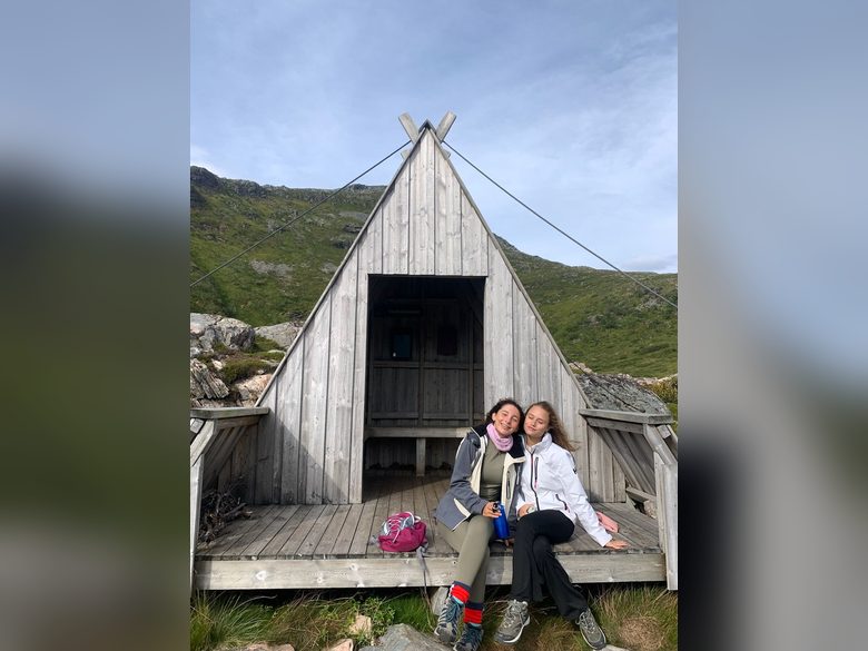
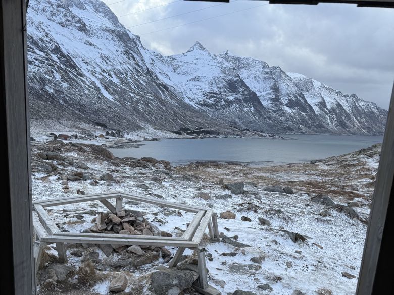
A quarter-hour of easy walking brings you to a gapahuk — an open timber shelter with a fine view over Skjelfjorden, and its own small outdoor library on the wall.
For groups with small children, the gapahuk is the perfect turning point. Bring something to drink, sit a while, walk down again — a complete small adventure.
The steep pull
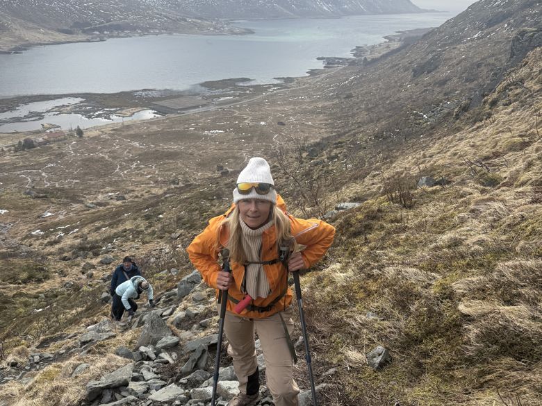
Past the gapahuk the trail turns properly uphill for a stretch. Take it steadily; it does not last long.
The ridge
The ground flattens out onto the ridge. The view opens with every step, the ground turns stony underfoot, and the top stands ahead.
The summit — 457 m
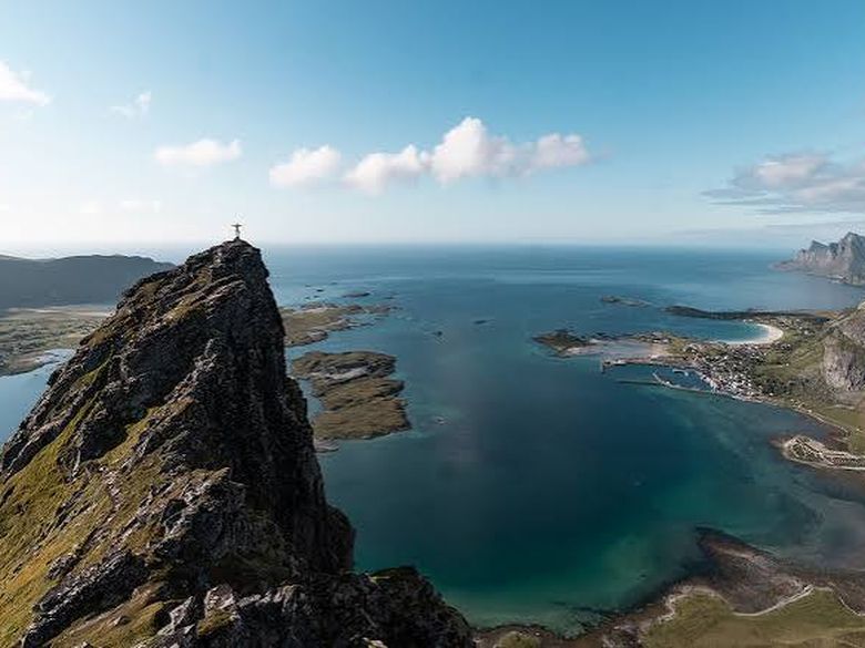
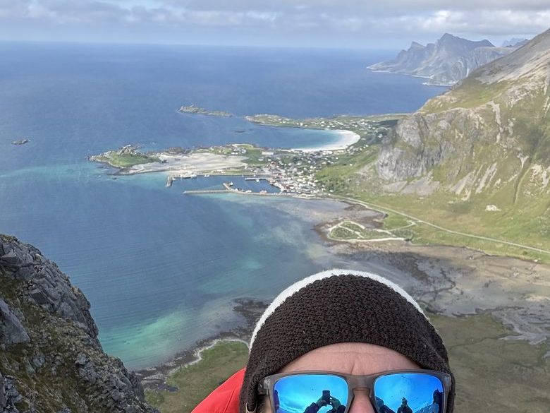
At the top, walk a few paces around and the panorama turns full circle: Kvalvika's bay to one side, Fredvang and its bridges, the whole open sea running north, Rambergstranda's white curve, and the long line of Skjelfjorden leading your eye back out the way you came.
The Volandstind trailhead lies about 1.8 km from the house — a 20–25 minute walk, measured point by point by the hosts. Our guests' favourite summit starts before the car does.
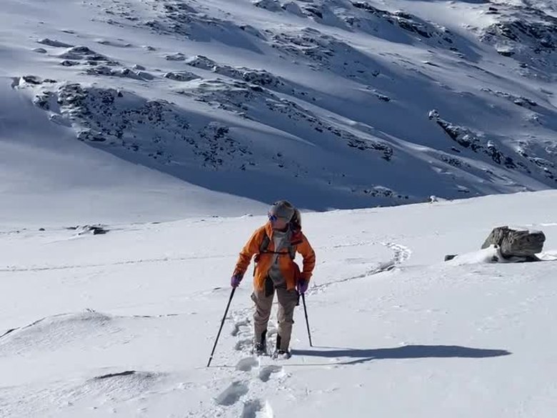
On the way up — summer and winter
Photos from the trail
Timing it right
Midnight sun
Late May to mid-July, Volandstind is superb for it — an evening ascent with the sun standing over the northern sea is this mountain at its best.
Summer days
Any clear window works. The ridge is a fine picnic line, and the trail rarely carries more than a handful of walkers.
Winter
One of the west's honest winter summits — for the properly equipped. Good footwear with spikes and poles usually carries the day; some days ask for snowshoes, depending on the snow. Judge the conditions, not the calendar.
Fog on the tops?
The sun often shines above the fog — a summit over a white sea of mist is one of the finest sights here. But if the cloud is thick and low, save Volandstind for tomorrow: the 360-degree view is the hike. Walk the coast instead.
Pack check
- Footwear with proper grip
- Wool base layer — plus a dry spare to change into at the top
- Wind- and rain shell
- Food and something to drink
- Hat
- Headlamp (if it gets dark)
- Winter: spikes and poles — if a lot of snow, consider snowshoes
Questions we actually get
How hard is Volandstind?
Moderate. One properly steep stretch above the gapahuk, otherwise honest, steady trail — neither long nor technical. Most reasonably active walkers manage it comfortably in 2–3 hours return.
Is Volandstind suitable for children?
The gapahuk certainly is: 15 minutes of easy walking to a shelter with a big view over Skjelfjorden — an ideal short family outing. The full summit suits older children used to walking; the steep section decides it.
Where do I park?
At the Skjelfjorden grendehus — the yellow community house on Skjelfjordveien. Good parking, and the trail starts right there.
Can I hike it in winter?
Yes — with proper equipment. Good winter footwear with spikes and poles usually suffices; some days need snowshoes, depending on snow conditions. One of the west's most rewarding winter summits for prepared hikers.
Is it good for the midnight sun?
One of the best in the west. The tops face the open northern sea, and an evening walk up in the midnight-sun weeks — roughly late May to mid-July — is the finest version of this hike.
How crowded does it get?
It doesn't. That is much of the point: a summit view to rival the famous ones, usually shared with almost no one.
What do I see from the top?
A full circle: Kvalvika, Fredvang and its bridges, the open sea northward, Rambergstranda, and the length of Skjelfjorden below you.